Randonnée A pied Eggendorf im Traunkreis - Naturlehrpfad - Photo

Tous les sentiers balisés d’Europe PRO

© OpenStreetMap contributors
Longueur
Longueur
5 km
Altitude max
Altitude max
381 m
Dénivelé positif
Dénivelé positif
56 m
Km-Effort
Km-Effort  
5,7 km
Altitude min
Altitude min
337 m
Dénivelé négatif
Dénivelé négatif
46 m
Boucle
Boucle
Oui
Balise
Balise
Date de création :
2022-02-16 16:48:25.6
Dernière modification :
2022-03-03 12:18:13.965

(0 Avis)

A pied
A pied
1h17
Difficulté : Facile

Scannez ce code QR pour ouvrir la randonnée dans l'application SityTrail

Application GPS de randonnée GRATUITE

Logo SityTrail SityTrail

IGN / Instituts géographiques

Télécharger SityTrail sur l'App Store Télécharger SityTrail sur Google Play

Logo SityTrail SityTrail World

Le monde est à vous

Télécharger SityTrail sur l'App Store Télécharger SityTrail sur Google Play Télécharger SityTrail sur Huawei AppGallery

À propos

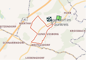
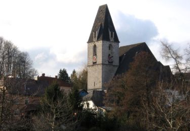
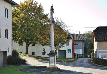
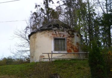
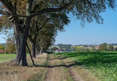
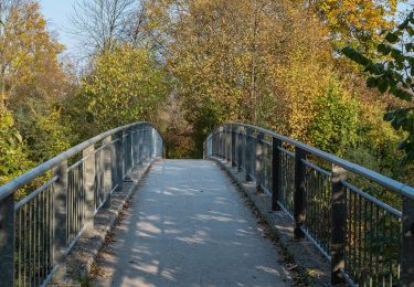
Randonnée A pied de 5 km à découvrir à Haute-Autriche, Bezirk Linz-Land, Eggendorf im Traunkreis. Cette randonnée est proposée par SityTrail - itinéraires balisés pédestres.

Description

Randonnée créée par Gemeinde Eggendorf im Traunkreis.

Symbole: gelber Hinweispfeil mit schwarzem Text "Naturlehrpfad"

Photos

Localisation

Pays :
Autriche
Région :
Haute-Autriche
Département/Province :
Bezirk Linz-Land
Commune :
Eggendorf im Traunkreis
Localité :
Unknown
Départ:(UTM)
436405 ; 5331110 (33U) N.

Randonnées à proximité

Randonnée A pied Schleißheim - AVE-Runde - Photo
A pied
PRO

A pied

Facile
Schleißheim, Haute-Autriche, Bezirk Wels-Land, Autriche
7,7 km | 9,3 km-effort
2h 7min
Oui
Randonnée A pied Kematen an der Krems - Bauernroas - Photo
A pied
PRO

A pied

Facile
Kematen an der Krems, Haute-Autriche, Bezirk Linz-Land, Autriche
9 km | 10,7 km-effort
2h 26min
Oui
Randonnée A pied Eggendorf im Traunkreis - 4 Gemeinden Wanderweg - Photo
A pied
PRO

A pied

Facile
Eggendorf im Traunkreis, Haute-Autriche, Bezirk Linz-Land, Autriche
12,3 km | 14,7 km-effort
3h 20min
Oui
Randonnée A pied Piberbach - Wanderweg Winden - Photo
A pied
PRO

A pied

Facile
Piberbach, Haute-Autriche, Bezirk Linz-Land, Autriche
8,3 km | 9,5 km-effort
2h 9min
Oui
Randonnée A pied Allhaming - Rundwanderweg Allhaminger Forst - Photo
A pied
PRO

A pied

Facile
Allhaming, Haute-Autriche, Bezirk Linz-Land, Autriche
9,8 km | 12,3 km-effort
2h 47min
Oui
Randonnée A pied Allhaming - Rundwanderweg Lindach - Photo
A pied
PRO

A pied

Facile
Allhaming, Haute-Autriche, Bezirk Linz-Land, Autriche
13,8 km | 17,3 km-effort
3h 55min
Oui
Randonnée A pied Allhaming - Rundwanderweg Sipbach - Photo
A pied
PRO

A pied

Facile
Allhaming, Haute-Autriche, Bezirk Linz-Land, Autriche
12,3 km | 14,7 km-effort
3h 20min
Non
Randonnée A pied Allhaming - Rundwanderweg Laimgräben - Photo
A pied
PRO

A pied

Facile
Allhaming, Haute-Autriche, Bezirk Linz-Land, Autriche
11,6 km | 14,4 km-effort
3h 16min
Oui
Randonnée A pied Kematen an der Krems - Tassiloweg - Photo
A pied
PRO

A pied

Facile
Kematen an der Krems, Haute-Autriche, Bezirk Linz-Land, Autriche
4,7 km | 5 km-effort
1h 8min
Non


Fermer
Mes abonnements